
Survey
“The map is not the territory,” is how Gregory Bateson put it in Steps to an Ecology of the Mind. I first heard that phrase in my serious, post-dropout years at Carolina, in an anthropology class. The professor who taught the course went on to some renown, and I visited him in the summer of 1979 at a farm he had bought in the Ozarks, where he had gone to live out his theories on sustainability. (I’m not sure how long he lasted there; I made it about a day. Last I heard from him he was teaching again in the midwest.)
I thought about this map / territory thing as I sat at my desk in late October, staring at the Google Maps image of our land on my computer. In a few minutes I was to walk down the street to the bank and wire the funds to the seller to close the deal. Thinking of all that money flying through the aether, panic started to set in. How did we know this was the land we were actually buying? How did we know it was really 10 acres? What if it was all some elaborate ruse, cooked up by the real estate guys to fleece a couple of out of staters?
I felt a little like Hunter Thompson in the opening paragraphs of Fear and Loathing in Las Vegas. He’s cruising through the desert in a red Cadillac convertible in the company of his oversized Samoan lawyer when he’s set upon by imaginary bats, and freaks out. Like Duke, Thompson’s alter ego in the book, I felt compelled to call on our (non-Somoan) attorney for reassurance.
I found her on her cell phone somewhere in Chapel Hill. “I’m getting ready to go send this money out,” I said, “but then it occurred to me: how do we know we’re buying what we think we’re buying?”
The line was silent for a second as she no doubt wondered how what was supposed to be a straightforward legal matter had suddenly turned existential. “Well,” she replied (and the ‘what kind of idiot am I dealing with’ hung there on the line, unvoiced), “because it says so on the plat,” referring to the official county map. So there.
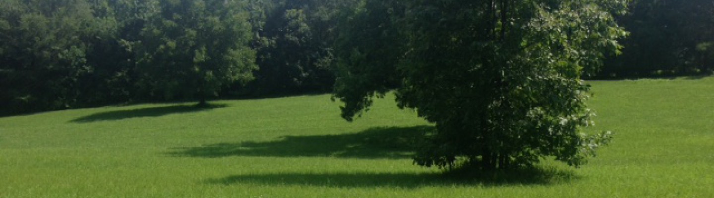
I was reminded of this while exchanging emails with the company we had hired to do a formal survey of the property. The process was taking a while, slowed by rain and the holidays, but they were finally about done. A few weeks earlier I had been down in Chapel Hill and had been out to walk around with my brother. With the undergrowth having died back, we headed into the woods, down to the creek at the bottom of the hill. We found some beautiful hardwoods there, and, in one place a tumbled down stone wall and a stretch of rusted barbed wire fence. In another, there was a collapsed chicken coop, a Southern Ozymandias. The creek, we assumed, marked the property line and we followed it until it reached the neighbor’s land to the south.
A month later I was again in my office when an email from the surveyor dropped into my inbox. The final survey doc was attached, including an overlay of the topographical lines from the county’s aerial map. It was a surprisingly exciting moment, seeing that on the screen. Even though it was still just a document, a PDF, something about having this in hand made the whole thing more real, more tangible. There were now known boundaries, stakes in the ground. With its demarcations and dotted lines, its charted angles and GPS coordinates, the map was becoming territory. And it held one further surprise: the creek was 50 feet inside the eastern boundary of our land.
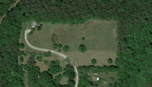
Photo: Our land starts at the vertical tree line just past where it says Eco Drive, and goes up and to the right. It includes the field and surrounding woods on two sides.
